 TECHNOMALIST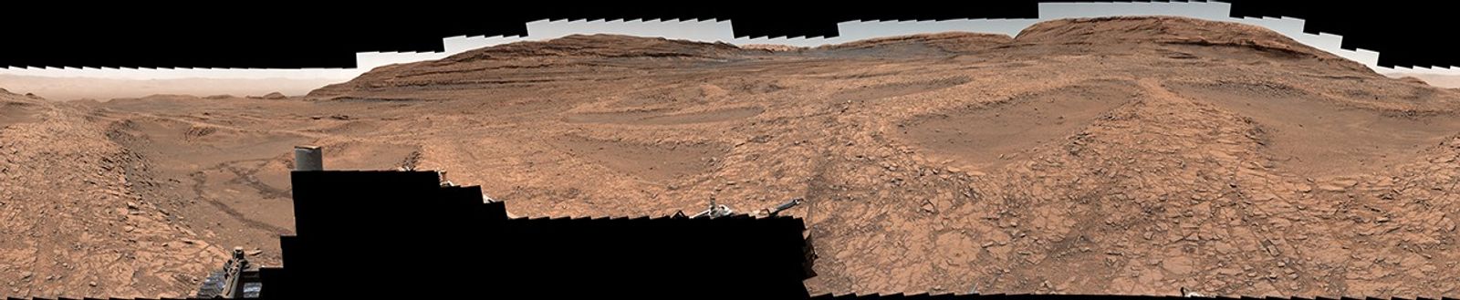
NASA’s Curiosity Mars rover has beamed back images of the most extensive honeycomb‑textured terrain it has ever encountered, a vast patchwork of polygonal fractures carpeting the floor of a valley known as Valle Grande.
Curiosity’s mast camera took a 360‑degree panorama on June 19 and 20 (Martian sols 4,930 and 4,931), revealing what the mission team calls a “sea of polygons.” Each crack is roughly 1.5 to 3 inches wide and forms a repeating geometrical pattern that stretches out in all directions.
Project scientist Ashwin Vasavada said the team “measured their shapes and chemistry carefully and are hopeful there are clues in the data as to how these features formed.”
The rover had previously spotted small patches of similar polygonal fractures, but NASA says nothing on the scale of the Valle Grande field has been found before. The texture covers a significantly larger area than earlier examples, making it an important new puzzle for planetary geologists.
The site is in the lower foothills of Mount Sharp, a 3‑mile‑tall mountain Curiosity has been climbing since 2014. NASA notes that billions of years ago lakes and streams dotted this region, leaving behind sedimentary rocks that the rover has been studying for signs of past water.
Earlier, smaller polygon patches gave clues about the processes that can create these shapes. Some were clearly formed as mud cracks, a sign that liquid water once saturated the ground and then dried. But the agency cautions that multiple mechanisms can produce honeycomb textures. Cycles of warming and cooling, or compression that squeezes water out of buried sediment, could also be responsible. The precise origin of the Valle Grande polygons remains under investigation.
The discovery adds a new chapter to Curiosity’s long‑running mission to understand whether ancient Mars had conditions suitable for microbial life. By analyzing the rock chemistry and the geometry of the cracks, scientists hope to decipher the environmental history of this part of Gale Crater.
The panorama is part of the rover’s ongoing survey as it traverses the foothills of Mount Sharp, a region that preserves a layered record of Martian history. Each new vista helps researchers piece together when and how water may have flowed on the surface.
The Verge reported the update, citing NASA’s latest mission status. Gizmodo first noted the significance of the panorama.
See an error? Read our corrections policy or email [email protected].